Cycle path of the Sicilian Natural Parks – MTB
Cycle path of the Sicilian Natural Parks - MTB
Description
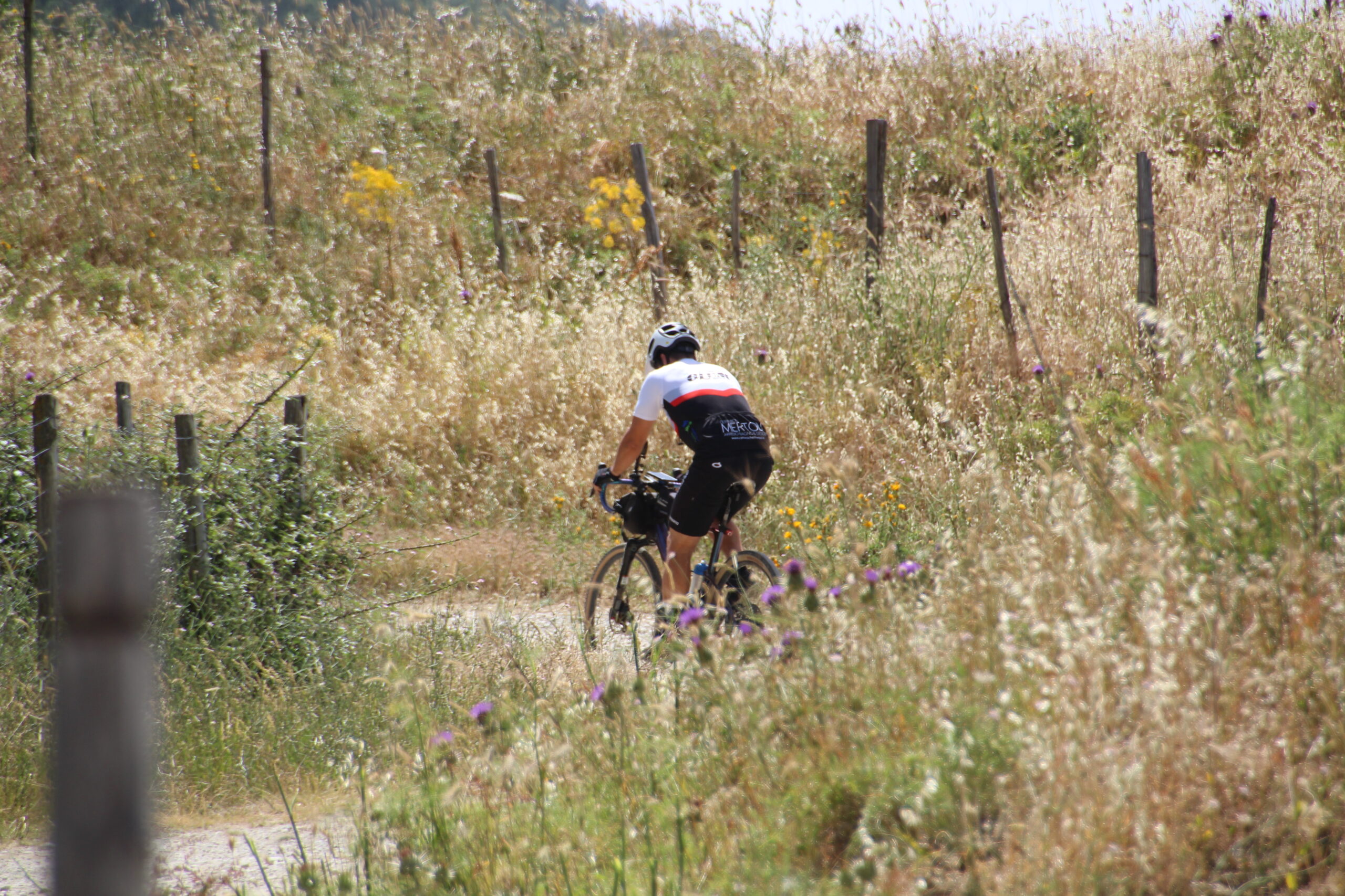
Exploring Sicily by mountain bike is an extraordinary experience that allows you to immerse yourself in the culture, nature, and culinary heritage of this fascinating island.
The MTB itinerary of the Ciclovia dei Parchi of Sicily is the perfect way to discover, in freedom and independence, the true essence of this beautiful island through a wide range of grounds: from the volcanic territory of Etna to the suggestive cliffs up to the Tyrrhenian coasts. The path crosses four of the main Nature Parks in Sicily. A mountain bike allows you to tackle these terrains effectively and excitingly, allowing you to explore hidden and authentic places.
Enjoy every moment of your trip and discover all that this magnificent land offers.
An extraordinary adventure that you will never forget!
Itinerary
Day 1 - from Rifugio Sapienza to Francavilla di Sicilia
From Rifugio Sapienza begins the first stage which, with a total length of about 58 km, leads to Francavilla di Sicilia.
The itinerary will snake along the Altomontana slope of Etna, which can be traveled only by bike, on foot, or on horseback; along uncontaminated landscapes, ancient lava flows and old craters, passing by oak and pine woods.
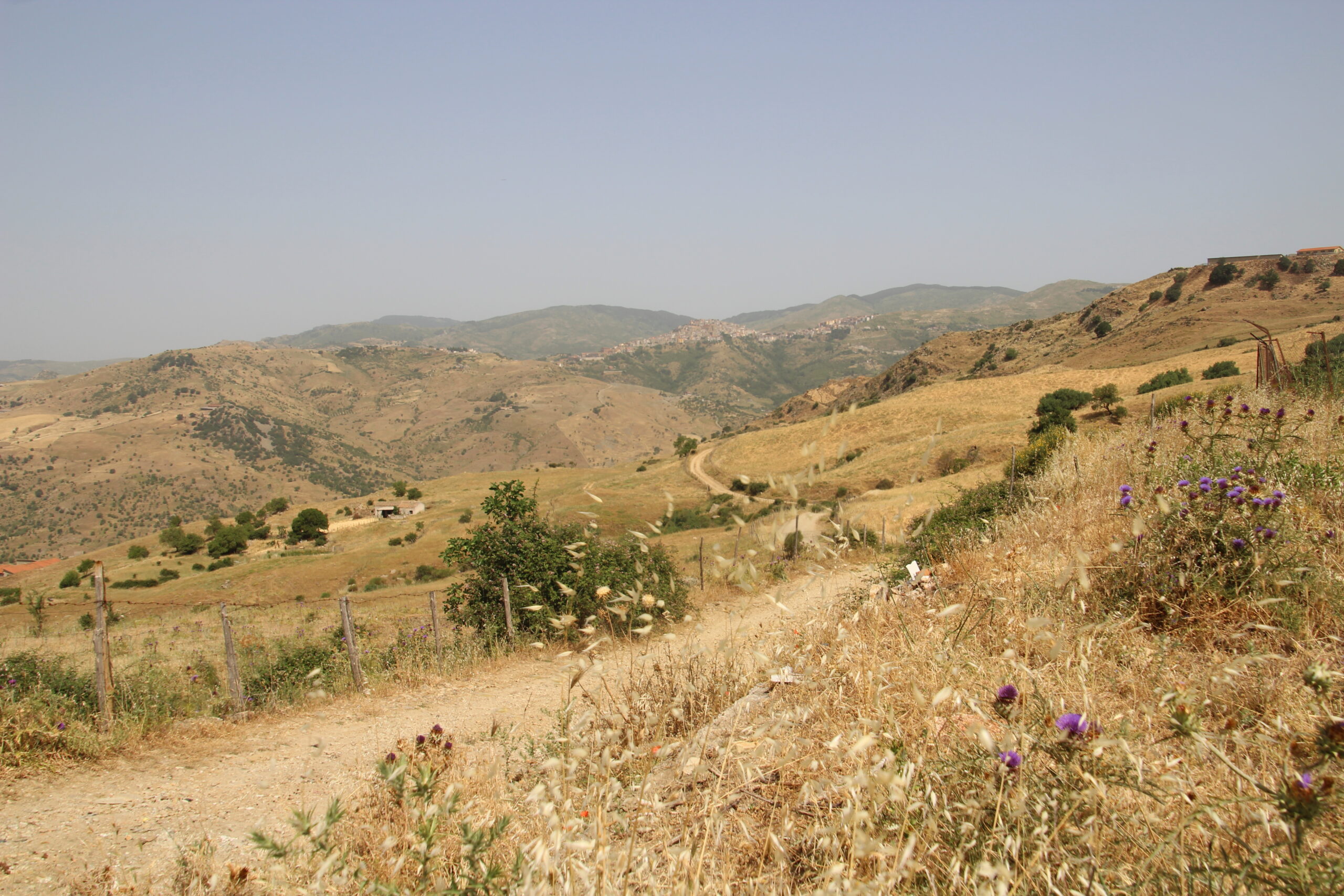
This route will lead to Etna Nord and then head towards Alcantara River Park. Along the road, you will first cross the pine forest Ragabo, a natural formation at an altitude of 1400 m consisting mainly of pine larch always a resource for the territory of Linguaglossa. Linguaglossa is a town rich in churches of high artistic and cultural value and is also known for typical culinary products such as sausage cut to the stump and prestigious wines. After about 10 km, you will reach Castiglione di Sicilia, designated as one of the “most beautiful villages in Italy” in 2017, rich in art, culture, views, and breathtaking views. Here is the Church of Santa Domenica, one of the oldest Byzantine cubes in Sicily.
The final stretch, about 10 km long, will end in Francavilla di Sicilia or “Francavigghia” in Sicilian, home to important cultural sites such as the Antiquarium and the Convent of the Friars Minor Capuchin with its herbarium of medicinal plants typical of the area, and one of the access points to the Gurne of Alcantara.
Duration: about 04:30 h
Distance: about 58 km
Elevation gain: 730 m
Altitude difference: 2,300 m
Day 2 - from Francavilla di Sicilia to Floresta
From Francavilla di Sicilia begins the second stage in the heart of the Nebrodi Park that, with a total length of 34 km, leads to Floresta.
The first stretch about 12 km, will lead to the Oriented Nature Reserve of the Forest of Malabotta, in the Nebrodi Mountains. The centuries-old wood of the highest ecological, naturalistic, faunal and environmental value; is one of the oldest woods in Sicily and became a Natural Reserve in 1997. With its 3,222 hectares and from 700 to 1300 meters above sea level, it is one of the largest nature reserves on the island, as well as the reserve with the highest gradient.
The area is a valuable environment from a geomorphological and ecological point of view with a wide variety of geological formations of clay sediments and limestone rocks. One of the distinctive elements of this area seems to be the presence of plants of centuries-old age, in particular the “Patriarchs of the Wood”, secular oaks with stems of over two meters in diameter.
In addition, the described vegetation includes a wide range of species such as oak, beech, chestnut, holly, holm oak and much more.
The undergrowth seems diversified, from humid environments to flowered prairies, with the special mention of the Wild Peony (Paeonia officinalis) covering the prairie in spring, an important habitat for many species of insects, birds, and other animals.
The route will continue to the final destination of Floresta.
Duration: about 04:00 h
Distance: about 34 km
Elevation gain: 1,420 m
Vertical drop: 470 m
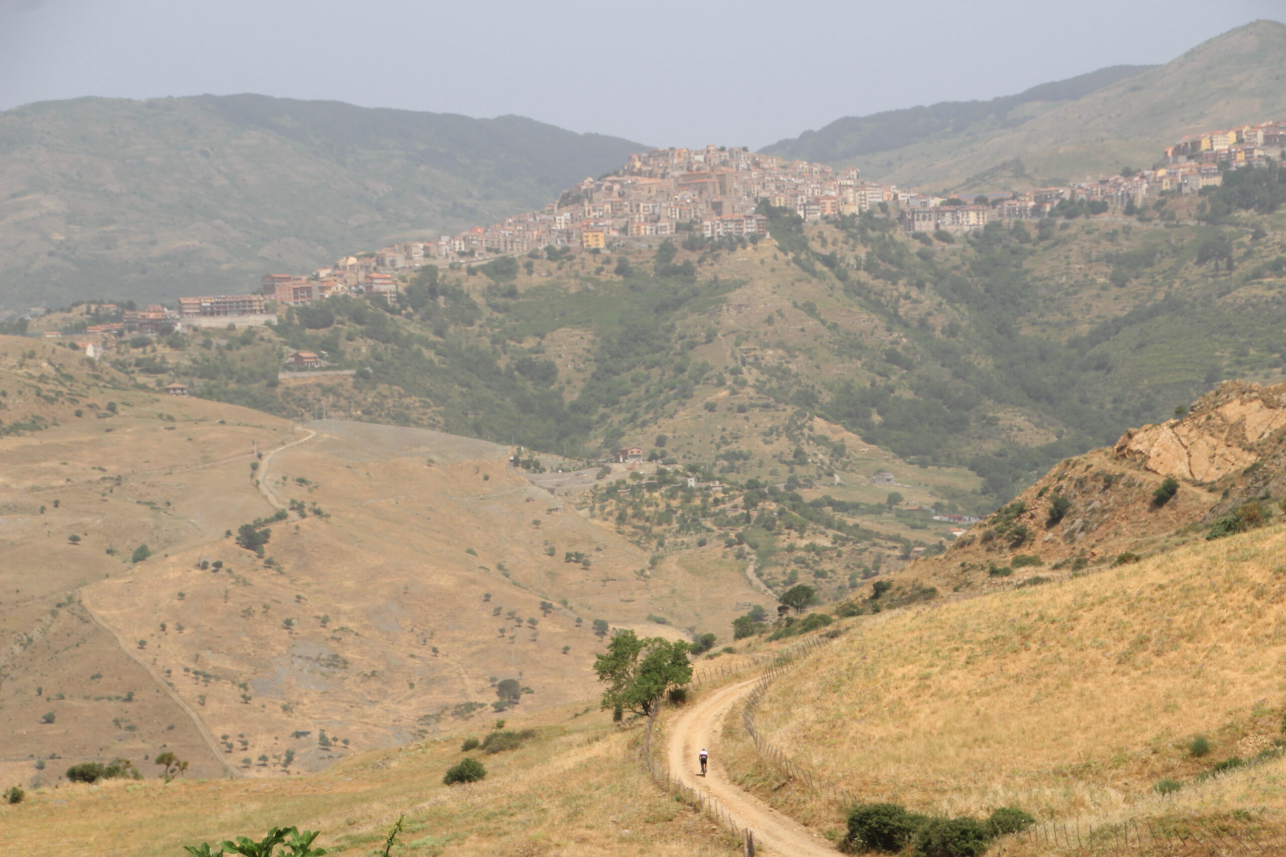
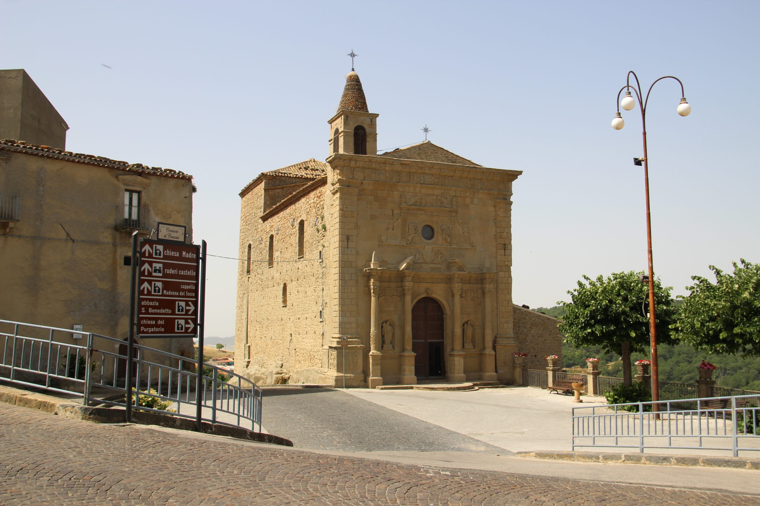
Day 3 - from Floresta to Capizzi
From Floresta, the highest town in Sicily located at 1275 m above sea level in the Nebrodi Mountains, begins the next stage of the MTB route of the Ciclovia dei Parchi of Sicily. The small town of just 500 inhabitants is characterized by a particular nineteenth-century architecture that distinguishes the main monuments of the territory, among which are the Town Hall and the Chiesa Madre di Sant’Anna.
This stage, which crosses the watershed between the Tyrrhenian and the Ionian Sea, as well as the entire ridge of Nebrodi, covering the length of this mountain range of northern Sicily, will end after about 64 km in Capizzi.
This area is known for its natural beauty, spectacular mountain landscapes, forests, unique flora, and fauna, and the famous “Pecorino dei Nebrodi”, a very seasoned and tasty cheese made from sheep’s milk.
Duration: about 06:00 h
Distance: about 64 km
Elevation gain: 1,480 m
Altitude difference: 1,700 m
Day 4 - from Capizzi to Gangi
The fourth stage marks the exit from Nebrodi Park and the entrance into Madonie Park, starting from Capizzi to Gangi after a journey of about 63 km.
Capizzi is a place characterized by a picturesque mountain landscape, surrounded by woods, valleys and rivers. The mountain town is known for its peaceful atmosphere and its cultural heritage, including churches and historic buildings.
The final destination of the stage is Gangi, designated as one of the “most beautiful villages in Italy” in 2014 and recognized as Municipality “Jewel of Italy” in 2012, where you can immerse yourself in its medieval atmosphere. The medieval atmosphere of Gangi is still very evident in its cobbled streets, its well-preserved historical buildings, ancient churches and castles. The inhabitants of Gangi are known for their commitment to the preservation of local traditions and culture.
Duration: about 05:20 h
Distance: about 63 km
Elevation gain: 1,350 m
Altitude difference: 1,460 m
Day 5 - from Gangi to Rifugio Marini
The fifth stage of the Ciclovia dei Parchi starts from Gangi and, after a journey of about 40 km, ends at Rifugio Marini. This stage, almost all uphill, will thrill the most passionate cyclists and lead them to the highest altitudes of the Madonie.
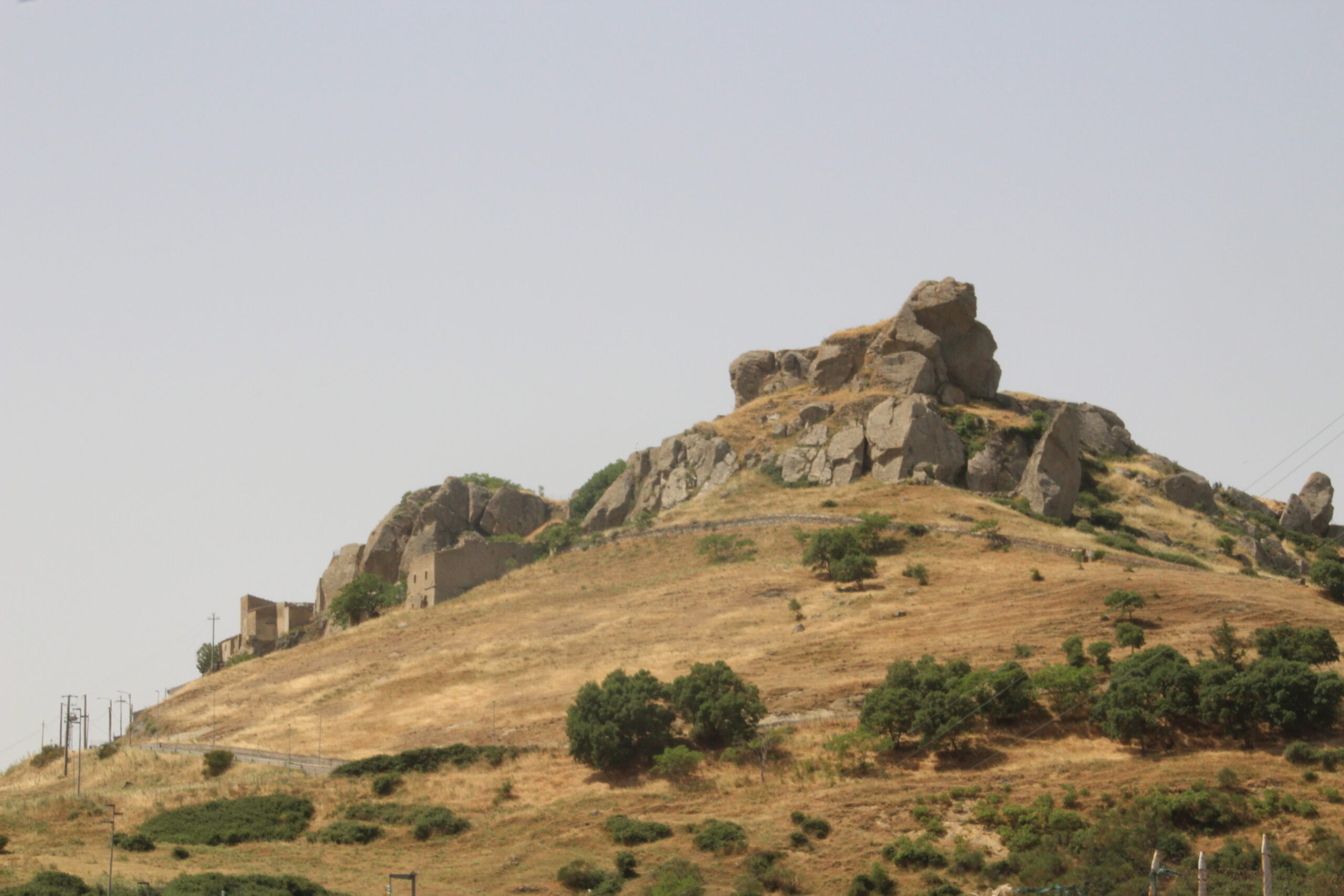
The first stretch, about 13 km long, will lead to the village of Petralia Soprana, which was designated as one of the “most beautiful villages in Italy” in 2018 for the maintenance of its medieval soul; and Petralia Sottana, famous for the cave of “Vecchiuzzo” in front of the village, in the so-called “Rocca delle Balate”.
The next destination, reachable after about 10 km, will be the Sanctuary Madonna dell’Alto, 1819 m on top of one of the highest peaks of Sicily and whose foundation dates back to the fourteenth-fifteenth century.
From here, continuing for about 10 km, you will arrive at Portella Colla, a starting point for wonderful excursions.
The last kilometers will lead to Piano Battaglia, the base of the ski slopes and bike services, where is located the Rifugio Marini, the final destination of the stage.
Duration: about 04:40 h
Distance: about 40 km
Elevation gain: 1,760 m
Altitude difference: 1,010 m
Day 6 - from Rifugio Marini to Cefalù
The sixth and last stage of the Ciclovia dei Parchi starts from Rifugio Marini and, after a journey of about 40 km, ends on the northern coast in Cefalù.
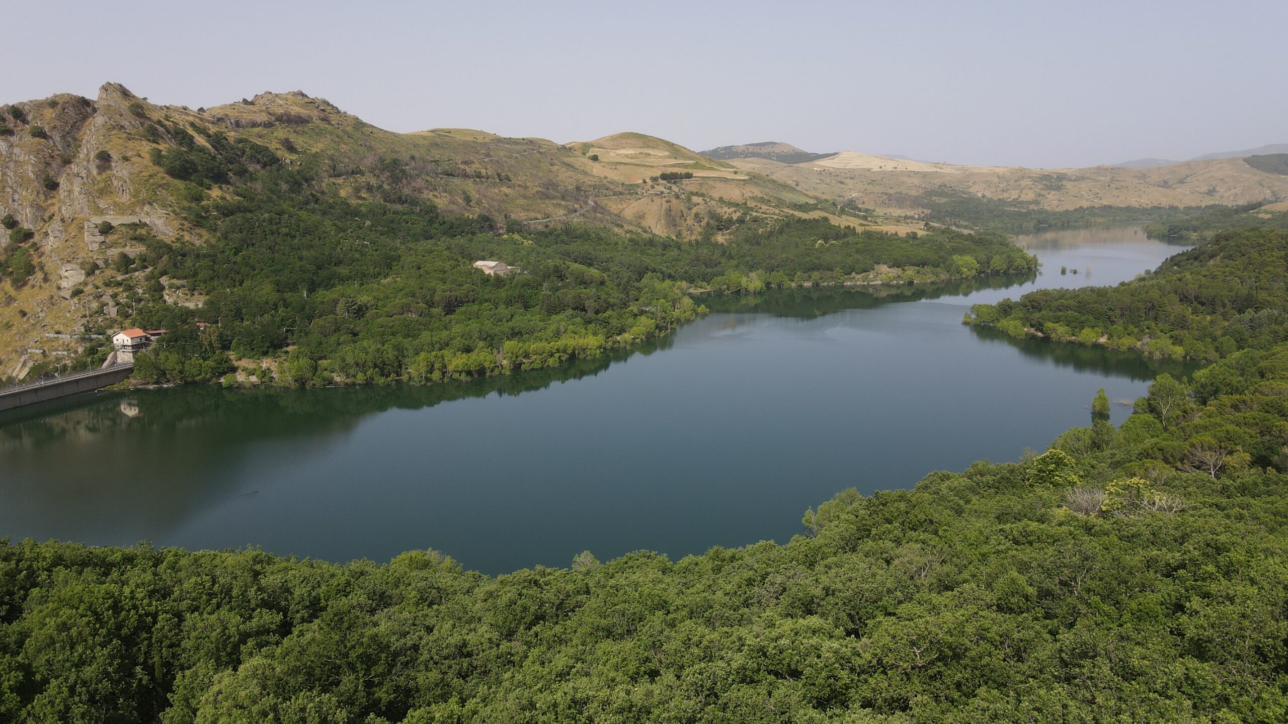
The first short stretch of about 5 km will arrive at the lake of Mandria del Conte, also known as Lake Piano Zucchi, a jewel hidden in the heart of the Madonie. Created in the mid-seventies, deviating the course of the Madonie Torrent to further enrich the beauty of the place, it represents the classic valley of the Madonie. What is striking is definitely the landscape, between greenery and mountains.
From here, cycling for another 15 km you will reach the Monastery of San Giorgio, whose foundation is attributed to Pope Innocent II around 1140.
The last 10 km will lead to the final destination of the Ciclovia dei Parchi of Sicily: Cefalu’, which was included among the “most beautiful villages in Italy”. The main church (the Duomo) has also been declared a World Heritage Site by UNESCO.
Duration: about 02:35 h
Distance: about 39 km
Elevation gain: 500 m
Altitude difference: 2,080 m
Richiedi gratuitamente la traccia.
- Possiamo aiutarti ad organizzare il tuo viaggio, seleziona i servizi di cui hai bisogno.